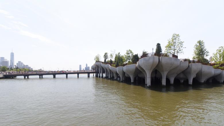
From Pier to Island
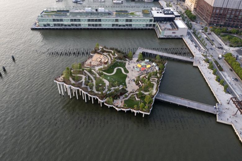
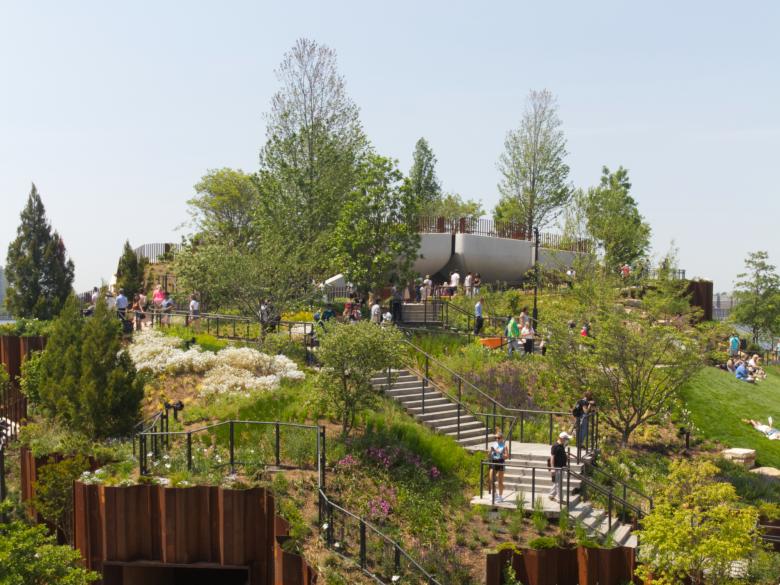
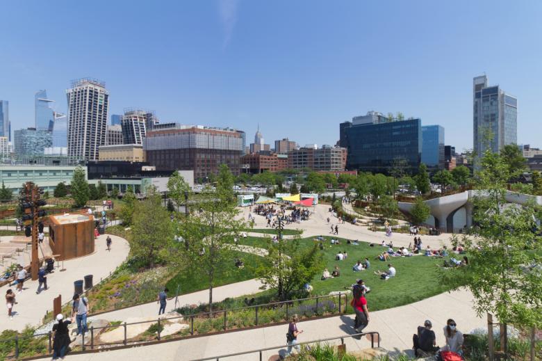
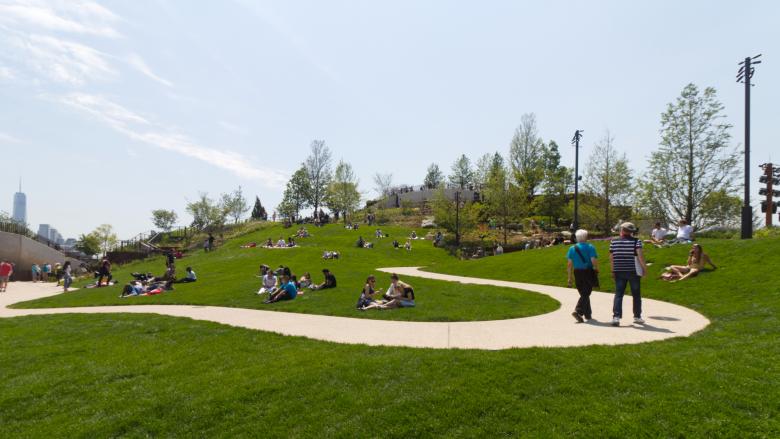
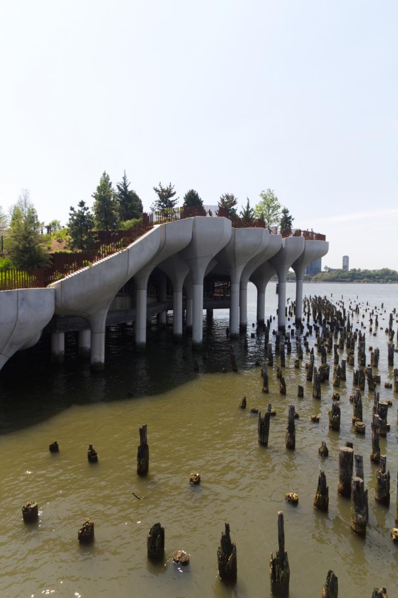
Little Island, formerly known as Pier 55, opened to the public on Friday, May 21. World-Architects visited on opening day to get some firsthand impressions of the much anticipated park. Here we present photos from that visit as well as a brief history of the industrial piers that once defined this edge of Manhattan.
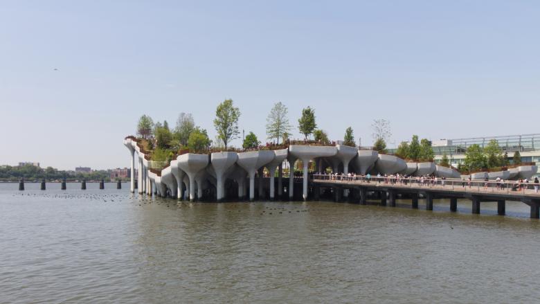
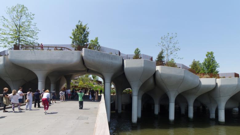
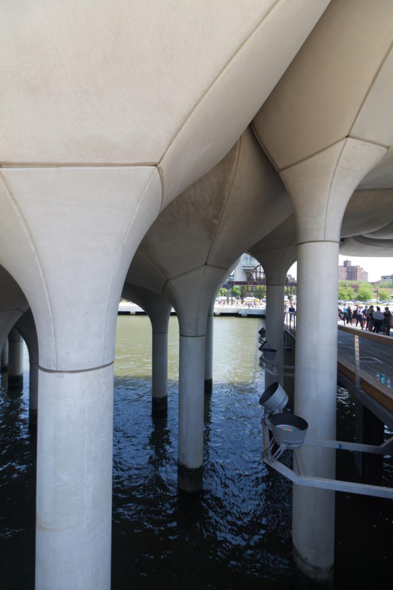
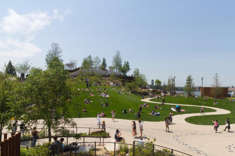
Rather than going into the soap opera-like story of how a $260 million, 2.4-acre park in the Hudson River paid for by billionaire Barry Diller and designed by Thomas Heatherwick actually happened — our coverage years ago had headlines describing the project as "Uncertain" then "Dead" then "Resurrected" — this article focuses on two intertwining strands: the design of Little Island as executed and its historical context; the first is described through photos and the second in the brief paragraphs between them.
Looking at the area's industrial past is not uncalled for; after all, Little Island is just one block from the southern end of the High Line, the elevated park that occupies a former railway viaduct. Similarly, Little Island sits on a stretch of the Hudson River that was primarily industrial, with dozens of piers jutting into the river from the bulkhead (seawall) that was built in the 1800s from the Battery north to 59th Street.
The original 19th-century plan for the Hudson River waterfront did not have any piers between Greenwich Village and Chelsea, but plans in the 1880s by the Department of Docks led to the construction of nine piers, from Little West 12th Street (Pier 53, just south of Little Island) north to 22nd Street. The stretch of piers was called Chelsea Piers, now the name of the sports complex that adaptively reused piers 59, 60 and 61 to the north.
The Department of Docks designed and engineered Chelsea Piers, which were completed in 1910, but the prominent elevations facing east were designed by Warren and Wetmore, who were designing Grand Central Terminal at the time. The architects designed pink granite facades that extended for a half-mile, giving unity to what was formerly a "hodgepodge of run-down waterfront structures."
Over the Chelsea Piers' five decades of use, it served as a passenger ship terminal, an embarkation point for soldiers in the two World Wars, and as a cargo terminal late in its life. Most famously, the piers were the end point for the maiden voyage of the Titanic in 1912. While that "unsinkable" ship obviously didn't make it, the Carpathia, which rescued 675 of the Titanic's 2,200 passengers, arrived at Pier 54 on April 20, 1912. Three years later, the RMS Lusitania left from the same pier and was sunk by a German U-boat before it could arrive in Britain.
East of the piers were north-south roads and railroad tracks that became known as "Death Avenue" due to freight trains hitting automobiles and pedestrians, a problem that dated back to the 1860s. The High Line, completed in 1932, was built to address safety issues and the same thinking — separating modes of traffic vertically — led to the construction of the West Side Highway between 1929 and 1951. An elevated highway was also the logical choice since its location directly east of the piers meant it enabled east-west access to the piers at grade.
The decline of most transatlantic passenger ships in the 1950s, combined with the relocation of the subsequent cargo companies to New Jersey one decade later, made the Chelsea Piers an industrial relic by the time Westway was proposed around 1970. A few years later, a section of the West Side Highway collapsed, closing the highway and giving momentum to the Westway plan that would have seen a 4.2-mile highway tunneled into new landfill in the Hudson River, from the Battery north to 42nd Street, creating parkland (by Venturi, Scott Brown and Associates) atop it but also parcels for future development.
After fifteen years of protests over environmental and other concerns, the city abandoned plans for Westway, paving the way for the Hudson River Park, which was born from the city's comprehensive waterfront plan from 1992 and the signing of the Hudson River Park act in 1997. Between 1999 and present, most of the linear park has been completed, from the Battery north to 59th Street, paralleling the rebuilt surface highway that is West Street.
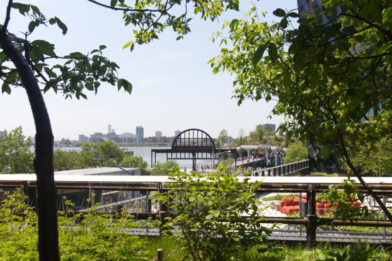
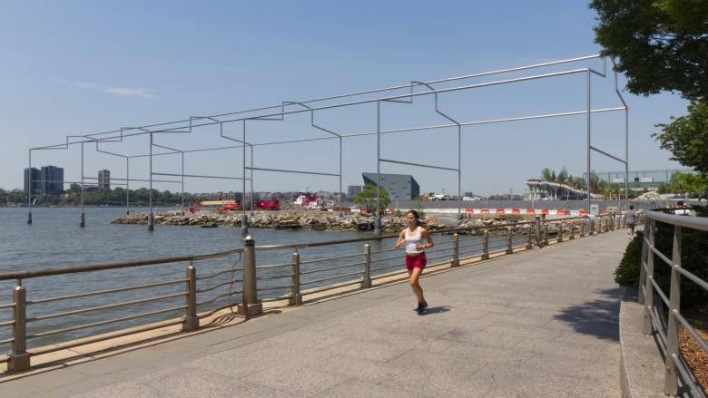
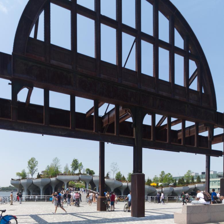
Occupying rebuilt piers and the inland north-south spine connecting them, Hudson River Park features a continuous bike path and recreational spaces that cater to the adjacent neighborhoods, with the landscape architects often working with community groups to determine what types of spaces (dog runs, restrooms, lawns, etc.) are provided. For many years, Pier 54 — just a concrete slab beyond the steel archway — was used for concerts and, in 2005, it was the inaugural venue for the Nomadic Museum designed by Shigeru Ban with a pitched roof over stacks of shipping containers.
In 2011, Pier 54 was closed, when parts of it started to collapse, but then it reopened the following spring as a place for beginner cyclists to practice basic bike skills. Then Hurricane Sandy hit in October 2012, further damaging what was left of the already brittle pier.
Then in 2013 Barry Diller started working with Hudson River Park Trust on plans for a Pier 54 replacement. Dubbed Pier 55 when the design by Thomas Heatherwick was unveiled in late 2014, the project was clearly more an island than a pier — set at an angle to the grid and linked to Manhattan via two spindly bridges. Although its design didn't change noticeably between November 2014 and May 2021, it is no surprise that the name of the project changed from Pier 55 to Little Island in November 2019: a reflection of its design and the negation of the area's industrial past.
